
 7
7 
 1
1 
Circuit Bomal-sur-Ourthe (Durbuy) - The Saint Rahy walk
Bomal
On foot || Middle || 4:00 ||
 9.86 km


 2
2 


Beauraing 2
Beauraing
On foot || Middle || 4:00 || Trail || Middle || 2:00 ||
15.0 km
 croix jaune 2

Walking trail Hotton -17- Walk along the stones
Hotton
On foot || Middle || 1:50 ||
7.01 km


Belvaux - Les Bouvreuils - The rapids of the Lesse
Rochefort
On foot || Middle || 2:00 ||
5.63 km


Les Rouges-Gorges
Belvaux
On foot || Middle || 3:45 || People with limited mobility || Pushchair ||
10.0 km


UNESCO Global Geopark Famenne-Ardenne : Geotrail of Beauraing


Begin your walk around Beauraing by walking through the Parc du Castel with its castle perched on the heights of the Calestienne, looking down across the town and the Famenne depression. Once you have left behind the town centre, its narrow lane and the site of the apparitions of the Virgin Mary, the rest of the trail continues along the limestone strip. This trail will take you to unusual geosites such as the Neuville travertine and the Martouzin take-off area. The final part of the trail follows a pretty GR footpath between the fields and the wall of the Parc de Castel.
IGN MAP

AERIAL PHOTOS / IGN


SLOPE MAP (IGN PLAN)


MAP 1950 / IGN

MAP OF THE GENERAL STAFF (1820-1866)


OPEN STREET MAP


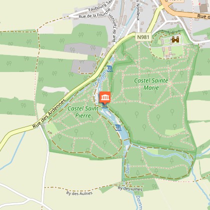
Starting point
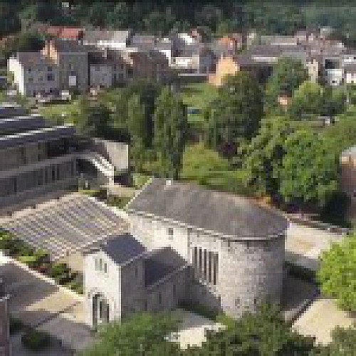
Castel Saint-Pierre Communal Park
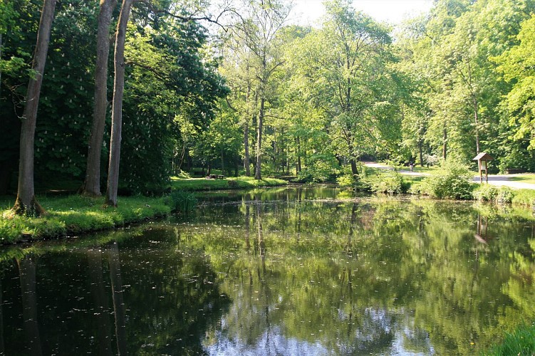
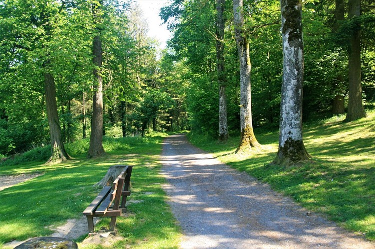
The trail starts from the Castel SaintPierre municipal park just a few minutes from Beauraing town centre. The park runs along the valley of a stream, the Dammaron, and features a series of ponds, low cliffs and woods occupying a total of 27 hectares. This is a wonderful spot for all kinds of leisure activities, from walking to fitness circuits and jogging or mountain-biking trails. There are a number of picnic areas with barbecues that are free for visitors to use. The park owes its name to the ancient Romanesque chapel, now a listed monument, dedicated to the first Bishop of Rome, Saint Peter. This park leads naturally into the Parc
du Castel Sainte-Marie, a 32-hectare estate that also offers endless opportunities for walks. There is no physical separation between the two parks, the first of which is municipal and the second of which is owned by the association ASBL Pro Maria but is open to the public. The two parks sere originally one, forming the 59-hectare “gardens” of Beauraing Castle. For those with an interest in botany, there is a small arboretum featuring over 50 forest species and a variety of different sorts of vegetation characteristic of the Calestienne. Approaching the exit, you will notice several sequoias, planted in the latter half of the 19th century. For the geology buffs, the upper car park stands on Eifelian sandstone but, as you head north, you
will gradually find yourself in an area of limestone rocks. It is mainly in the stream valley that you will find the
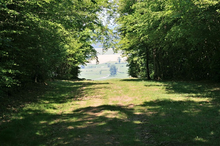
finest outcrops. This walk will take us to the secondary entrance to the Parc du Castel Sainte Marie some 1,500metresNNE on Rue du Luxembourg. Of all the possible options, we opted for a route using paths and tracks that can sometimes be a little steepbut offers a wilder, rockier setting.
Limestone banks
In geological terms, ever since we passed the little depressions in the rock, we have been following the first
massive limestone beds. These are clearly visible not only to the naked eye (depressions, rocks), but also on the relief map. These depressions are in fact former small-scale limestone workings. In the past, the land belonging to the town was dotted with quarries of different sizes, all now disused. The limestone extracted was used for building stones, pavements and aggregates, and also as raw material for the lime kilns, one magnificent example of which can still be seen on the main road (Rue des Ardennes) near the lower entrance to the Parc du Castel. Lime kilns were used to calcinate limestone (CaCO3) into quicklime (CaO) at temperatures of 600-800ºC.
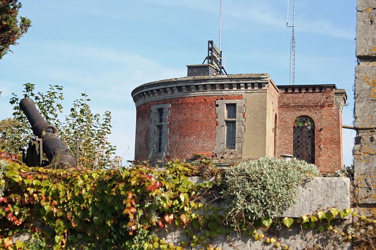
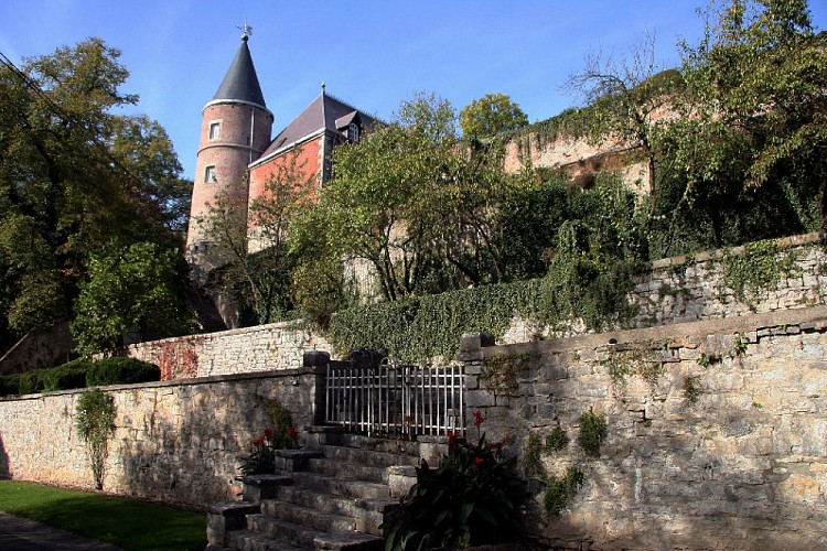
La Castel Sainte Marie
À gauche, on peut voir les ruines du château de Beauraing et de ses dépendances. En suivant la route, juste avant les tours monumentales et sur votre droite, un espace aménagé offre un très beau point de vue sur la ville de Beauraing, la Famenne et le Condroz.
Le château fut construit au moyen-âge sur le rebord septentrional de la Calestienne. Cet emplacement apportait au château une position surplombant Beauraing et la Famenne. Plusieurs épopées chevaleresques émaillent l’histoire du château. Il fut détruit une première fois en 1436. Il sera rapidement reconstruit. D’autre événements catastrophiques suivirent, le château sera notamment rasé à la fin de la révolution française. Il restera ainsi jusqu’en 1855, quand le propriétaire, le duc d’Osuna, décida de le restaurer de fond en comble. On a estimé le montant des travaux à 300 millions de l’époque. C’est la période glorieuse du Château de Beauraing. Dans les serres des jardins, dont subsistent encore quelques ruines, on pouvait rencontrer des plantes et des arbustes du monde entier : orangers, citronniers, palmiers et cactus. Il paraitrait même que deux singes y avaient élu domicile. C’est également le temps où les invités d’honneur ne manquaient pas. Notamment le prince de Galles, futur roi d’Angleterre, fut en 1880 accueilli entre ces murs. Le château fut malheureusement presque entièrement détruit par un terrible incendie la nuit du 3 décembre 1889. En effet, suite à la mort soudaine du duc d’Osuna, des ouvriers occupèrent les bâtiments afin d’emballer l’ensemble des biens et meubles qui devaient être transportés jusqu’à Cologne. Ces derniers s’aidaient de lampes au pétrole pour s’éclairer durant leurs travaux et malencontreusement l’accident arriva. Au matin du 4 décembre, il ne restait que des ruines. En 1946, l’asbl «Pro Maria» faisait l’acquisition d’une moitié de l’ancienne propriété des Ducs d’Osuna, comprenant notamment le Château.
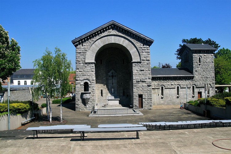
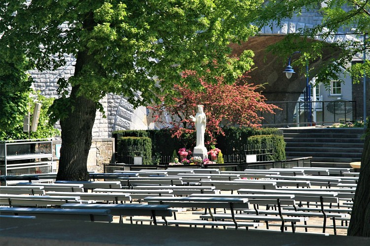
Sanctuary of Beauraing and site of the Apparitions
You have now reached the site of the Apparitions of the Virgin Mary, now a sanctuary and a place of pilgrimage. The story behind this site relates that, between 29 November 1932 and 3 January 1933, five Beauraing children witnessed apparitions of the Virgin on 33 occasions. After much reluctance and opposition from all sides, the diocesan authorities concluded, after rigorous investigation, that the children were telling the truth. Worship at the site was authorised in 1943, and the supernatural nature of the events
acknowledged in 1949. The spot at which the apparitions occurred, beneath a hawthorn tree (aubépine), is open to the public night and day. The space around the tree is now enclosed and in it stands a statue of the Virgin, with steps up to the plinth for placing candles and flowers at her feet: it is a focal point of reflection and prayer for visitors. Work began in 1947 on building a Votive Chapel in local limestone. Beautifully carved, it now forms the heart of the sanctuary. Further buildings were gradually added, built in concrete and starkly streamlined in design. They include the Shelter, which surrounds the Garden of the Apparitions, the Crypt of Saint John, the church of the Rosary, with capacity for 700 worshippers, and the Upper Church, with capacity for up to 5,000 pilgrims.
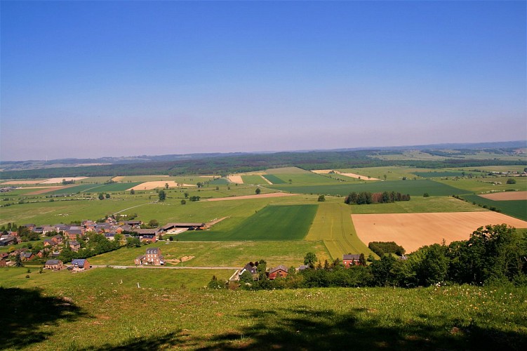
Martouzin take-off area
The Beauraing-Martouzin take-off point for paragliders and hang gliders is reserved for members of the Belgian free-flight association (Fédération Belge de Vol Libre, FBVL)and of associate foreign federations. The spot stands some 100 metres above the Famenne depression, and offers a magnificent lookoutpoint over the
depression, with the Condroz in the distance.
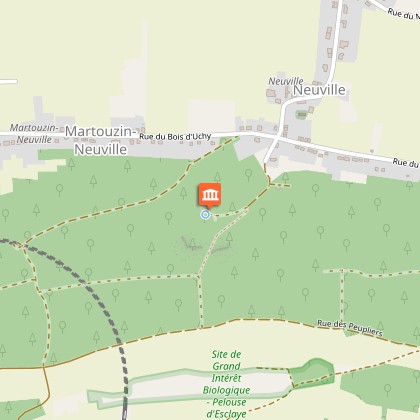
Neuville Travertine
You are now in a small disused quarry. Below you, you will see water emerging from the earth at different points. If you look closely, at the foot of the springs, you will see a new type of rock, known as travertine. The Neuville site consists of a series of small springs of highly mineralised water that are actively depositing travertine. The travertine, which in this instance could also be described as calcareous tufa, is still at a very early stage, still very soft and rich in plant debris. It is very fragile, and walking on it would destroy it, which is why visitors are asked not to walk anywhere near the springs.
Good to know : Travertine is a porous sedimentary continental rock created when a crust of limestone is deposited on vegetation. The term calcareous tufa is used to describe travertines that are still very soft (not to be confused with volcanic tufa). Travertineis deposited at certain springs (incrusting springs) and sometimes in shallow watercourses with small waterfalls. When the highly mineralised water (rich in calcium and magnesium carbonate) reaches the surface, it releases CO2, causing limestone to precipitate. The spongy appearance of the rock is partly due to the disappearance of plant debris, incrusted by the calcite, as it ferments. Some particularly hard travertines, such as those quarried in Tivoli in Lazio Roma, is hard enough to be used for construction (it was used, for example, in the building of the Colosseum). Other younger and softer forms, like that of Neuville, are highly fragile.

5580 Rochefort


