
 1
1 
 7
7 
Circuit Bomal-sur-Ourthe (Durbuy) - The Saint Rahy walk
Bomal
On foot || Middle || 4:00 ||
 9.86 km


 2
2 


Beauraing 2
Beauraing
On foot || Middle || 4:00 || Trail || Middle || 2:00 ||
15.0 km
 croix jaune 2

Walking trail Hotton -17- Walk along the stones
Hotton
On foot || Middle || 1:50 ||
7.01 km


Belvaux - Les Bouvreuils - The rapids of the Lesse
Rochefort
On foot || Middle || 2:00 ||
5.63 km


Les Rouges-Gorges
Belvaux
On foot || Middle || 3:45 || People with limited mobility || Pushchair ||
10.0 km


The Castle of Durbuy
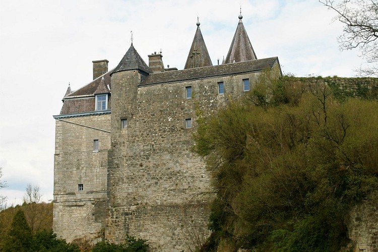

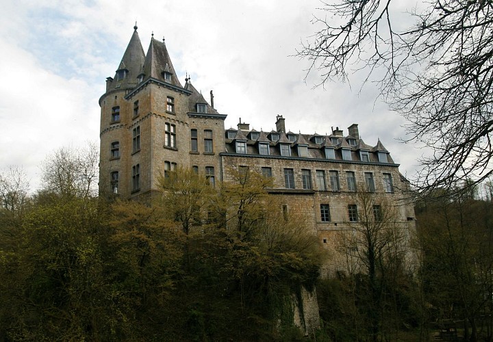

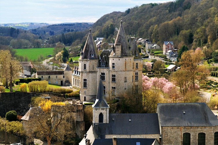

The town of Durbuy grew up on an island encircled by a meander cutoff of the River Ourthe, a position of great strategic importance. The site relied for its defence on the river surrounding the fortified enclosure, and on the castle, built on a rocky spur. It was not until the 18th century that the meander was drained and filled in, leaving the dry bed of the former course where you now stand. Facing you stands the Chateau.
The town of Durbuy, first mentioned in written records in 1078, owes its existence to the castle. This landmark has had a chequered history, falling prey over the course of time to fire, dilapidation and destruction, alternating with periods of reconstruction. In its earliest form, the fortress was built primarily for military purposes, consisting of a platform on which stood a number of buildings and towers making up the fortifications. Accommodation was restricted to the bare minimum. From the 15th century onwards, the castle was to offer more comfortable quarters as rooms were added on the town side of the keep. The castle survived a number of wars before finally being razed by French troops in the 17th century. In 1731, the Duc d’Ursel, lord of Durbuy from 1726, embarked on its reconstruction. What he built, however, was not a fortress but a château, a courtly residence on the banks of the Ourthe. The chateau underwent further radical changes around 1880- 1882, giving it the neo-Gothic style it retains to this day. As the riverbank reveals, the base of the chateau rests on the limestone rock itself, providing solid foundations for the chateau. Between the chateau and the cutoff stands an impressive folded rock formation:the small anticline (geological details below). This anticline, along with outcrops along the course of the Ourthe, reveals the existence of a rock several metres in height on which the chateau is built, makingit a natural vantage point over the surrounding terrain.
IGN MAP

AERIAL PHOTOS / IGN


SLOPE MAP (IGN PLAN)


MAP 1950 / IGN

MAP OF THE GENERAL STAFF (1820-1866)


OPEN STREET MAP


Author Information

5580 Rochefort


