
 1
1 
 7
7 
Circuit Bomal-sur-Ourthe (Durbuy) - The Saint Rahy walk
Bomal
On foot || Middle || 4:00 ||
 9.86 km


 2
2 


Walking trail Hotton -17- Walk along the stones
Hotton
On foot || Middle || 1:50 ||
7.01 km


Beauraing 2
Beauraing
On foot || Middle || 4:00 || Trail || Middle || 2:00 ||
15.0 km
 croix jaune 2


Belvaux - Les Bouvreuils - The rapids of the Lesse
Rochefort
On foot || Middle || 2:00 ||
5.63 km


Les Rouges-Gorges
Belvaux
On foot || Middle || 3:45 || People with limited mobility || Pushchair ||
10.0 km


Saint Remacle Church
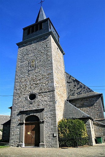

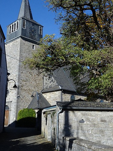

The church of Saint Remacle, with its imposing square tower, dates from 1766 and was originally dedicated to Saint Martin. And yet it lies at the centre of a fortified place dating from feudal times, although the enclosure and the ditch have been breached at several points. The archaeological excavations also revealed a gateway into the enclosure. The line of the enclosure is fairly easy to trace, since it corresponds
fairly closely to the lanes surrounding the church and the former parish cemetery.This 18th century building is an integral part of Wellin’s scenery and played an important role in its history, including serving as a place of refuge for the townsfolk in times of war.Inside the church, you will find Romanesque baptismal fonts dating from the early 13th century. Interestingly, given the nature of the soil found in the Famenne-Ardenne Geopark, the fonts are flanked by four limestone heads standing 94 cm high.
IGN MAP

AERIAL PHOTOS / IGN


SLOPE MAP (IGN PLAN)


MAP 1950 / IGN

MAP OF THE GENERAL STAFF (1820-1866)


OPEN STREET MAP


Author Information

5580 Rochefort


