
 7
7 
 1
1 
Circuit Bomal-sur-Ourthe (Durbuy) - The Saint Rahy walk
Bomal
On foot || Middle || 4:00 ||
 9.86 km


 2
2 


Beauraing 2
Beauraing
On foot || Middle || 4:00 || Trail || Middle || 2:00 ||
15.0 km
 croix jaune 2

Walking trail Hotton -17- Walk along the stones
Hotton
On foot || Middle || 1:50 ||
7.01 km


Belvaux - Les Bouvreuils - The rapids of the Lesse
Rochefort
On foot || Middle || 2:00 ||
5.63 km


Les Rouges-Gorges
Belvaux
On foot || Middle || 3:45 || People with limited mobility || Pushchair ||
10.0 km


Sohier, One of the Most Beautiful Villages in Wallonia
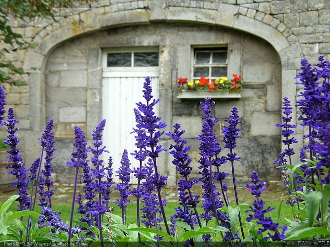


Sohier stands on the borders of the Calestienne and the Ardennes, and is famous for its architectural heritage: this includes in particular its many traditional houses and its 13 farms, all now beautifully restored and maintained, but not forgetting its scenic views, its ancient oak, the Gros Chêne, its former school, the church of Saint-Lambert (1870) and the presbytery. It is the quality and uniformity of its buildings, most built from natural stone in the 19th century, that has earned Sohier recognition as one of the “Most Beautiful Villages in Wallonia”. The photo shows a section of the outer wall of one of the village farmhouses. Alongside the greyish limestone fieldstones (easily identified by their smooth surface), you can also see various colours of sandstone (generally greenish, but sometimes brownish or red and with a rough surface). But the villagers of Sohier can also take some of the credit for the accolade bestowed on their village: every year, at the start of summer, the entire village is filled with flowers. Sohier also has a long history. The burial ground discovered at the spot known as “Le Gibet” (the gibbet) has yieldedevidence of Gallo-Roman occupation in the 1st century. Excavations have revealed pottery, coins and other artefacts. In later times, the village grew up around its fortress, which was originally encircled by a moat. Over a period of four centuries, just three families, all inter-related, held the Seigneury and castle of Sohier.
IGN MAP

AERIAL PHOTOS / IGN


SLOPE MAP (IGN PLAN)


MAP 1950 / IGN

MAP OF THE GENERAL STAFF (1820-1866)


OPEN STREET MAP


Author Information

5580 Rochefort


