
 1
1 
 7
7 
Circuit Bomal-sur-Ourthe (Durbuy) - The Saint Rahy walk
Bomal
On foot || Middle || 4:00 ||
 9.86 km


 2
2 


Beauraing 2
Beauraing
On foot || Middle || 4:00 || Trail || Middle || 2:00 ||
15.0 km
 croix jaune 2


Walking trail Hotton -17- Walk along the stones
Hotton
On foot || Middle || 1:50 ||
7.01 km


Belvaux - Les Bouvreuils - The rapids of the Lesse
Rochefort
On foot || Middle || 2:00 ||
5.63 km


Les Rouges-Gorges
Belvaux
On foot || Middle || 3:45 || People with limited mobility || Pushchair ||
10.0 km


The Cave of Lorette
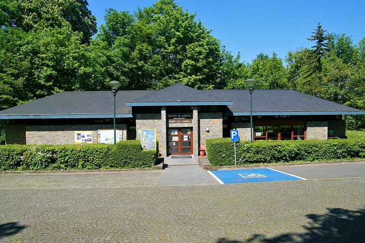

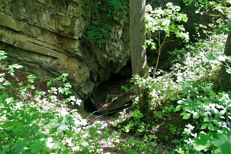

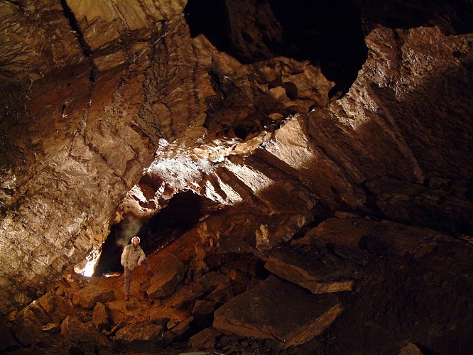


You are now standing on the plateau of Notre Dame de Lorette, a mainly horizontal area that is simply an extension of the area on which the chateau stands, across the Rue de Jaquet valley. Seen from above, the plateau features a number of deep hollows. When not man-made in origin (shell holes, excavation), such hollows are often caused by the underlying limestone dissolving and the land sinking to form these depressions, known as sink-holes or dolines. They are also surface clues to the probable existence of underground caves. What you see before you here are the morphological forms typical of a karst landscape. The Cave of Lorette or Rochefort Cave is run on a rather unusual pattern, as a tourist attraction but
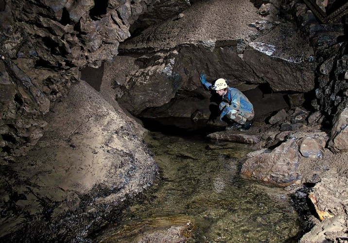
also as a place of scientific research that then communicates its results to the public. This makes it one of the major geosites within the Geopark. The Cave of Lorette extends over six kilometres of galleries beneath the plateau, some of which are open to visitors, while others are used as an underground laboratory. The location of this laboratory was chosen following the discovery of an active fault within the cave that is altering the shape of certain galleries or very gradually crushing blocks of stone and concretions. The laboratory focuses its studies on geophysics (studying faults, seismology and gravimetry) and hydrogeology (studying how water percolates through rock). Although an underground river once ran through the cave, most of the
galleries are now dry. Small underground rivers and lakes can still be found in some places, however, proof
that the Cave of Lorette is connected to a much larger system, much of which is still to be discovered: the
Lomme-Wamme underground system. These two rivers flow down from the Ardenne but when they reach the limestone, they follow the limestone strip rather than cutting perpendicularly across it, as the Lesse does at the Caves of Han. As they follow the course of the strip, the Lomme and the Wamme both gradually disappear underground, giving rise to a highly complex underground flow, mostly heading in the same direction as surface flows. The waters emerge once again at the Eprave resurgence. At the Nou Maulin Cave, this flow cuts across the surface meander encircling the town of Rochefort.
Further information
Useful information
Karst is a term that refers to all the surface and underground features resulting from the erosion of largely carbonate rocks: hollow depressions (sink-holes or dolines), dry valleys, river swallow holes (adugeoirs and chantoirs), major springs re-emerging from under the earth (resurgences), and caves and caverns (grottes, gouffres) of all shapes and sizes. The term itself derives from the eponymous region of Carso or Kras, a limestone plateau located for the most part in Slovenia but also extending into Italy and Croatia. A fluvial terrace (fluviatile) is a flattish ledge along one or both sides of a valley forming the bed of a former watercourse into which the water has sunk. A terrace may also be alluvial, created by the deposition of sediments, or flattened out by the erosion of either a rocky bed (strath terrace), or of an earlier terrace (entrenched terrace).
IGN MAP

AERIAL PHOTOS / IGN


SLOPE MAP (IGN PLAN)


MAP 1950 / IGN

MAP OF THE GENERAL STAFF (1820-1866)


OPEN STREET MAP


Author Information

5580 Rochefort


