
 1
1 
 7
7 
Circuit Bomal-sur-Ourthe (Durbuy) - The Saint Rahy walk
Bomal
On foot || Middle || 4:00 ||
 9.86 km


 2
2 


Walking trail Hotton -17- Walk along the stones
Hotton
On foot || Middle || 1:50 ||
7.01 km


Beauraing 2
Beauraing
On foot || Middle || 4:00 || Trail || Middle || 2:00 ||
15.0 km
 croix jaune 2


Belvaux - Les Bouvreuils - The rapids of the Lesse
Rochefort
On foot || Middle || 2:00 ||
5.63 km

Les Rouges-Gorges
Belvaux
On foot || Middle || 3:45 || People with limited mobility || Pushchair ||
10.0 km


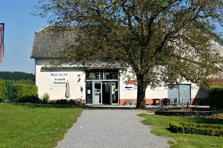
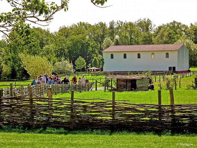
Malagne, Rochefort Archaeopark

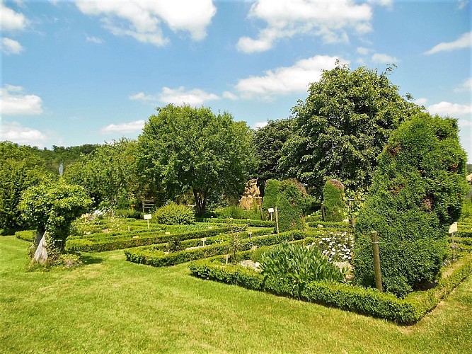

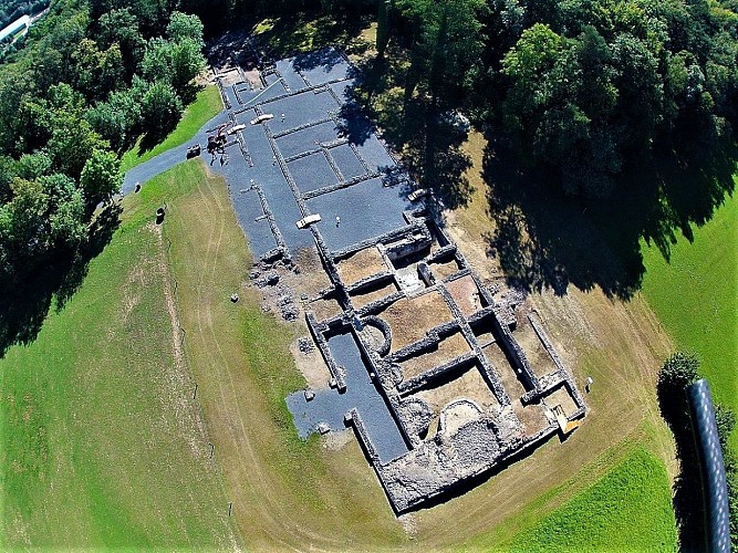


Malagne is an outstanding example of a Gallo-Roman rural estate that stands on the edge of the Calestienne, on a hill overlooking the Lomme valley to the south and an outpost of the Famenne depression
to the northwest. The limestone plateau of Gerny stretches to the northeast. This strategic position offered its early inhabitants a south-facing aspect on the boundary between the limestones and schists of the Devonian Period (385 million years ago). In common with the rest of the Gerny plateau, the loamy/stony soil, rich in limestone or schist, was ideal for growing crops. As with so many ancient sites, Malagne owes its location
not to chance but to a combination of advantageous geological and topographic features. The Malagne villa in Jemelle is the Geopark’s only sizeable landed estate, and was built in the middle of the 1st century AD; the ancient site is now a centre for learning, tourism and experimental archaeology (lime kiln).
Further information
Suggestion
Malagne, the Rochefort Archaeopark, a Geopark partner. Take time out to explore this superb geosite, with its remarkable wealth of historical and archaeological interest. Here you will also learn more about how the Romans and Gauls once lived, what they ate, the jobs they did, the crops they grew and the animals they raised. The site is open every day in July and August, and at weekends, on public holidays and during school holidays (from spring to autumn half-term holidays included). More information available on https://www. malagne.be/
IGN MAP

AERIAL PHOTOS / IGN


SLOPE MAP (IGN PLAN)


MAP 1950 / IGN

MAP OF THE GENERAL STAFF (1820-1866)


OPEN STREET MAP


Author Information

5580 Rochefort


