
 7
7 
 1
1 
Circuit Bomal-sur-Ourthe (Durbuy) - The Saint Rahy walk
Bomal
On foot || Middle || 4:00 ||
 9.86 km


 2
2 


Beauraing 2
Beauraing
On foot || Middle || 4:00 || Trail || Middle || 2:00 ||
15.0 km
 croix jaune 2


Walking trail Hotton -17- Walk along the stones
Hotton
On foot || Middle || 1:50 ||
7.01 km


Belvaux - Les Bouvreuils - The rapids of the Lesse
Rochefort
On foot || Middle || 2:00 ||
5.63 km


Les Rouges-Gorges
Belvaux
On foot || Middle || 3:45 || People with limited mobility || Pushchair ||
10.0 km


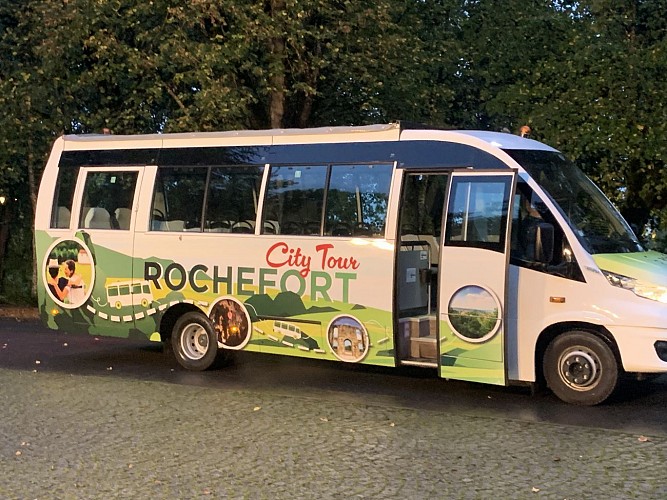
The little tourist train


Now retrace your steps and walk back down Rue du Coirbois. Back at the crossroads, turn right onto Rue de
la Martinette. After 450 metres, take Rue Louis Banneux on the left. After 250 metres, take a sharp right turn
and walk alongside the Lomme for 450 metres. When you come to the stone bridge, turn left across it and
then follow Rue de Behogne for 480 metres. Pass the church and, a little further on, you will find your final
stopping point on your left, opposite the cultural centre. You have now arrived at the last geosite on this trail: the little tourist train (www.rochefort. be/loisirs/tourisme/attractions/ TrainTouristique). A one-hour ride will (re)introduce you to Rochefort’s herRochefort 20 Famenne-Ardenne unesco global Geopark itage, both natural (the panoramic view from the Rond du Roi, the Lorette sink-hole) and historical (the Chateau of the Counts, the Lorette chapel, Malagne), with the help of an audio commentary in two languages.
IGN MAP

AERIAL PHOTOS / IGN


SLOPE MAP (IGN PLAN)


MAP 1950 / IGN

MAP OF THE GENERAL STAFF (1820-1866)


OPEN STREET MAP


Author Information

5580 Rochefort


