
 7
7 
 1
1 
Circuit Bomal-sur-Ourthe (Durbuy) - The Saint Rahy walk
Bomal
On foot || Middle || 4:00 ||
 9.86 km


 2
2 


Beauraing 2
Beauraing
On foot || Middle || 4:00 || Trail || Middle || 2:00 ||
15.0 km
 croix jaune 2


Walking trail Hotton -17- Walk along the stones
Hotton
On foot || Middle || 1:50 ||
7.01 km


Belvaux - Les Bouvreuils - The rapids of the Lesse
Rochefort
On foot || Middle || 2:00 ||
5.63 km


Les Rouges-Gorges
Belvaux
On foot || Middle || 3:45 || People with limited mobility || Pushchair ||
10.0 km


Ambly, a picturesque village
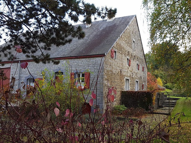


Ambly is a picturesque small village of 400 inhabitants within the municipality of Nassogne, right at the heart
of the Famenne-Ardenne Geopark. As you walk the narrow lanes of the village, you will have an opportunity
to admire a number of noteworthy buildings. In the village itself, you will pass many a stone-built farmhouse
dating from the early 19th century, most of which have been lovingly restored. Another striking architectural
feature is the number of magnificent half-timbered houses. Ambly has seen many battles throughout its history. The Duke of Luxembourg and the Prince-Bishop of Liège warred for many long years over control of the village lands. The village nevertheless remained a “fief” of the County of Rochefort, in the province of Namur, until 1976, when the two municipalities merged.
IGN MAP

AERIAL PHOTOS / IGN


SLOPE MAP (IGN PLAN)


MAP 1950 / IGN

MAP OF THE GENERAL STAFF (1820-1866)


OPEN STREET MAP


Author Information

5580 Rochefort


