
 1
1 
 7
7 
Circuit Bomal-sur-Ourthe (Durbuy) - The Saint Rahy walk
Bomal
On foot || Middle || 4:00 ||
 9.86 km


 2
2 


Beauraing 2
Beauraing
On foot || Middle || 4:00 || Trail || Middle || 2:00 ||
15.0 km
 croix jaune 2


Walking trail Hotton -17- Walk along the stones
Hotton
On foot || Middle || 1:50 ||
7.01 km


Belvaux - Les Bouvreuils - The rapids of the Lesse
Rochefort
On foot || Middle || 2:00 ||
5.63 km


Les Rouges-Gorges
Belvaux
On foot || Middle || 3:45 || People with limited mobility || Pushchair ||
10.0 km


The Chateau of Resteigne
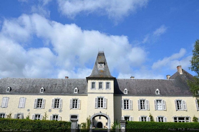

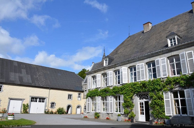

The chateau is your first geosite on this Famenne-Ardenne Geopark trail. As it stands today, the privately owned chateau is a rectangular construction, parts of which date from the 8th century. Standing on the bank of the Lesse, it is a solid building made from limestone fieldstone extracted from the nearby quarry. The main building and the gate tower in the listed façade date from the end of the 11th century. The chateau was built by the Merode family but in 1668 it passed into the hands of the Hoffschmidt family, made famous by the hermit philosopher Edmond d’Hoffschmidt (1777-1861). The reclusive philanthropist left an indelible mark on the village of Resteigne and its history. You will find references to his charitable works on his tombstone in the cemetery of Resteigne and in the ruins of his hermitage that you will come to further along the trail.
IGN MAP

AERIAL PHOTOS / IGN


SLOPE MAP (IGN PLAN)


MAP 1950 / IGN

MAP OF THE GENERAL STAFF (1820-1866)


OPEN STREET MAP


Author Information

5580 Rochefort


