
 1
1 
 7
7 
Circuit Bomal-sur-Ourthe (Durbuy) - The Saint Rahy walk
Bomal
On foot || Middle || 4:00 ||
 9.86 km


 2
2 


Walking trail Hotton -17- Walk along the stones
Hotton
On foot || Middle || 1:50 ||
7.01 km


Beauraing 2
Beauraing
On foot || Middle || 4:00 || Trail || Middle || 2:00 ||
15.0 km
 croix jaune 2


Belvaux - Les Bouvreuils - The rapids of the Lesse
Rochefort
On foot || Middle || 2:00 ||
5.63 km

Les Rouges-Gorges
Belvaux
On foot || Middle || 3:45 || People with limited mobility || Pushchair ||
10.0 km


The Devil’s Rocks
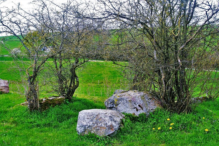

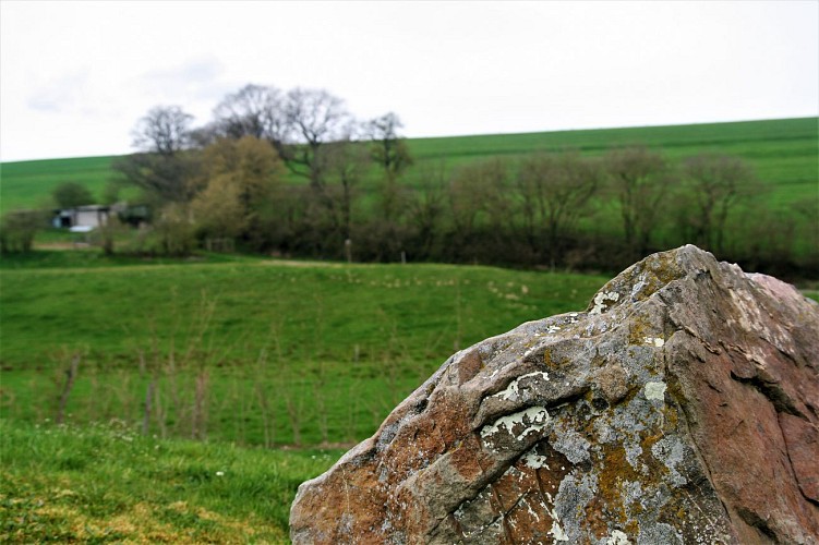

You are now at a spot known as “Inzomet” (the summit), a narrow promontory between two small streams, on which stands the megalithic site of the “Devil’s Load” or “Devil’s Rocks”. In the 19th century, the site consisted of 18 blocks of dressed sandstone. Sadly, many of the rocks were appropriated for the paving of a nearby road, and now only six remain. In the absence of any modern-day archaeological research, the site, which dates from the 3rd or 2nd millennium BC, retains most of its ancient mysteries intact and raises many unanswered questions as to how it would once have looked and what its purpose might have been. Its symbolic significance must have persisted down the generations, however, until the church felt the need to impose a Christian imprint on the site by installing a Calvary cross. This was reinforced by tales and legends associating the stones with the devil, designed either to terrify the local populace or incite them to destroy the site. Legend has it that the Devil was carrying a load of stones one day, but dropped them at this spot; under the largest of the stones, it is said, lies a treasure for the taking by whoever is able to lift the stone…
IGN MAP

AERIAL PHOTOS / IGN


SLOPE MAP (IGN PLAN)


MAP 1950 / IGN

MAP OF THE GENERAL STAFF (1820-1866)


OPEN STREET MAP


Author Information

5580 Rochefort


