
 7
7 
 1
1 
Circuit Bomal-sur-Ourthe (Durbuy) - The Saint Rahy walk
Bomal
On foot || Middle || 4:00 ||
 9.86 km


 2
2 


Beauraing 2
Beauraing
On foot || Middle || 4:00 || Trail || Middle || 2:00 ||
15.0 km
 croix jaune 2


Walking trail Hotton -17- Walk along the stones
Hotton
On foot || Middle || 1:50 ||
7.01 km


Belvaux - Les Bouvreuils - The rapids of the Lesse
Rochefort
On foot || Middle || 2:00 ||
5.63 km


Les Rouges-Gorges
Belvaux
On foot || Middle || 3:45 || People with limited mobility || Pushchair ||
10.0 km


The Resteigne Quarry
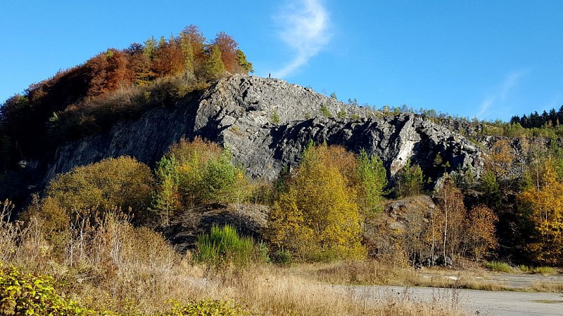


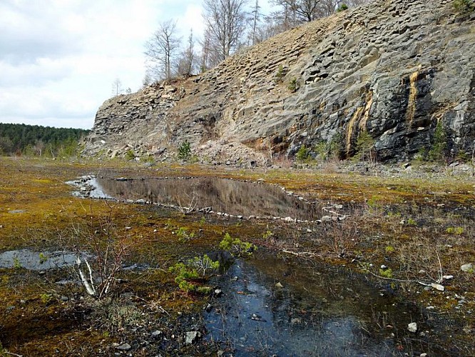

The quarry is now disused, but continues to attract regular visits from geology students at universities across Belgium, in part for the striking demonstration of stratigraphy it offers. The limestone found here dates from the height of the Eifelian and Givetian stages, from the Devonian period. This means it was formed in the primary era, some 90 million years ago. At that time, Resteigne lay beneath the shallow Devonian seas. It therefore comes as no surprise to find various marine fossils (corals, brachiopods, molluscs, crinoids and stromatopores) in the limestone of the quarry. The limestone extracted in Resteigne was highly reputed as “good building stone”, “dressing stone”, or for use as crushed stone. The quarry now provides a haven for a distinctive ecosystem, with a thriving population of extraordinary plant and animal life. Perhaps one of the most remarkable species found here is Oedipoda careulescens (the bluewinged grasshopper).
IGN MAP

AERIAL PHOTOS / IGN


SLOPE MAP (IGN PLAN)


MAP 1950 / IGN

MAP OF THE GENERAL STAFF (1820-1866)


OPEN STREET MAP


Author Information

5580 Rochefort


