

Circuit Beauraing - Balade nature entre Pondrôme et Revogne


Lovely nature walk through fields and woodland, along the rich natural and historic heritage of Pondrôme and Revogne: the unusual and impressive chapel on the hill, the Revogne chapel, the Lomprez gate (gate to the old medieval town),…Version A, via Esclaye Tourisme Board (Maison du Tourisme de Famenne-Ardenne Ourthe & Lesse) Place de l'Etang, 15 - 6900 Marche-en-Famenne T: +32(0)84/34.53.27 info@famenneardenne.bewww.famenneardenne.bewww.facebook.com/famenneardenne/www.instagram.com/tourismefamenneardenne #WeLoveFamenneArdenne
Further information
Signalétique (EN)
No signage
IGN MAP

AERIAL PHOTOS / IGN


SLOPE MAP (IGN PLAN)


MAP 1950 / IGN

MAP OF THE GENERAL STAFF (1820-1866)


OPEN STREET MAP


Starting point
5574 Pondrôme
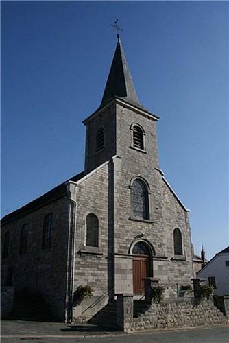
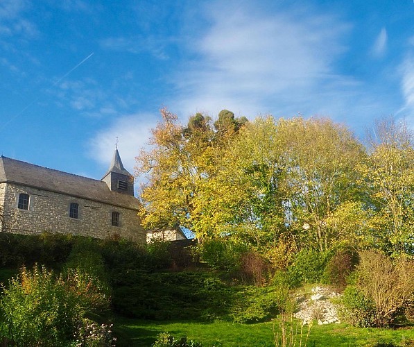
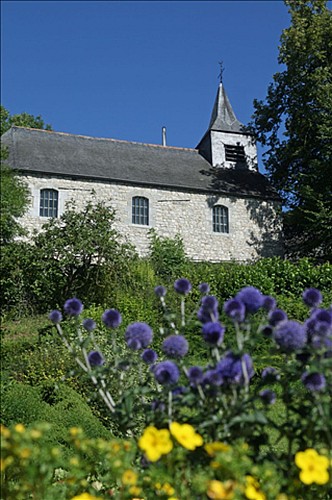
The Pondrôme church
The Pondrôme church is under the protection of Saints Cosma and Saint Damian, patron saints of surgeons. The church was built in the 19th century, but its foundations are far more ancient and go back to Roman times. Inside the church, you can even admire Roman baptismal fonts from the 13th century.Before you go on, walk round the church starting from the right and take a look at the ancient funeral slabs from the old graveyard which are embedded in the outside walls.
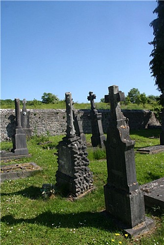
The Pondrôme graveyard
On your right hand side you can see the Pondrôme graveyard, which is considered as one of the most beautiful cemeteries in the area; it is planted with trees.
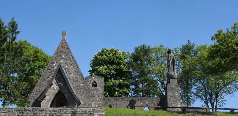
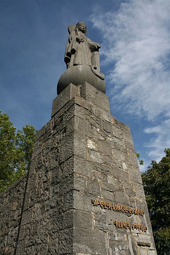
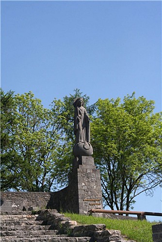
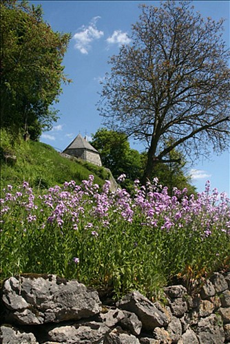
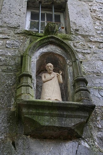
The chapel on the hill
This chapel is dedicated to the Holy Virgin and was built by the villagers to thank her for protecting them during the two World Wars. On the right of the chapel, you can see a rather impressive and distinctive statue of the Holy Virgin, the queen of the universe, crushing a snake’s head. The snake symbolises evil. The statue is the work of a renowned sculptor: Louis Thomas de Sohier.
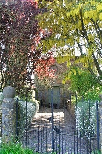
Esclaye chapel
Esclaye used to be the seat of a large parish comprising Pondrôme and a few other small villages. The destruction of the church was ordered by the revolutionaries, during the French occupation (circa 1800). The church was replaced in 1827 by this rather fetching neo-classical chapel.
Esclaye Farm
Nowadays Esclaye is a hamlet of the village of Pondrôme, but once it was a seigniory. The current castle (private property), which is set back from the main road, is still lived in by the descendants of the last Lords of Esclaye, the Villers-Masbourg family.
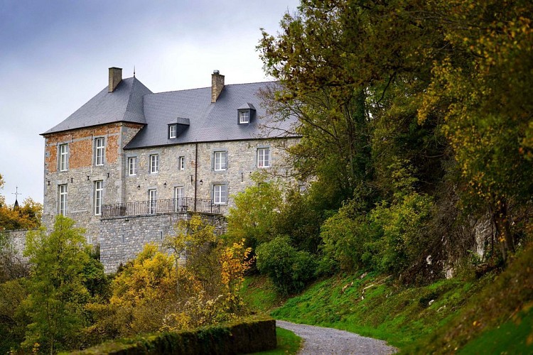
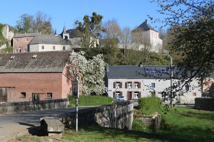
The Revogne castle-farm
On your right, on the village heights, you can see the castle-farm (no trespassing: private property) built in the 17th century and a bit lower, the Saint Etienne chapel, which bears a date stone that establishes its construction date as 1777.You can access the chapel and adjacent churchyard via a small path that winds its way up the rather steep hill.
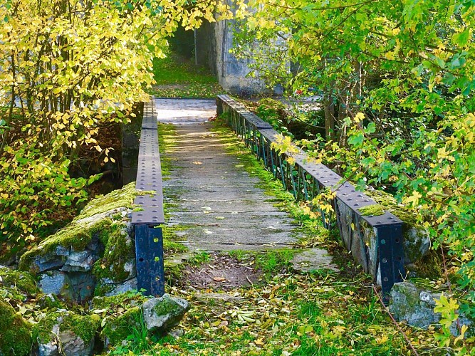
Bridge over the Wimbe
From this bridge, you can see all of the buildings that played an important part in Revogne’s past : the castle and the chapel on one side, and if you turn round, the last vestige of the stronghold : the Wellin portal. During the Middle-Ages, Revogne was a fortified city, an important military stronghold surround by ramparts which were destroyed in 1466 by Charles the Bold.
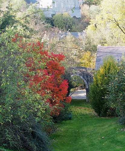
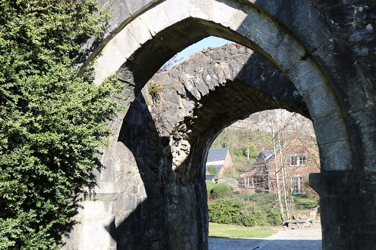
The Lomprez gate
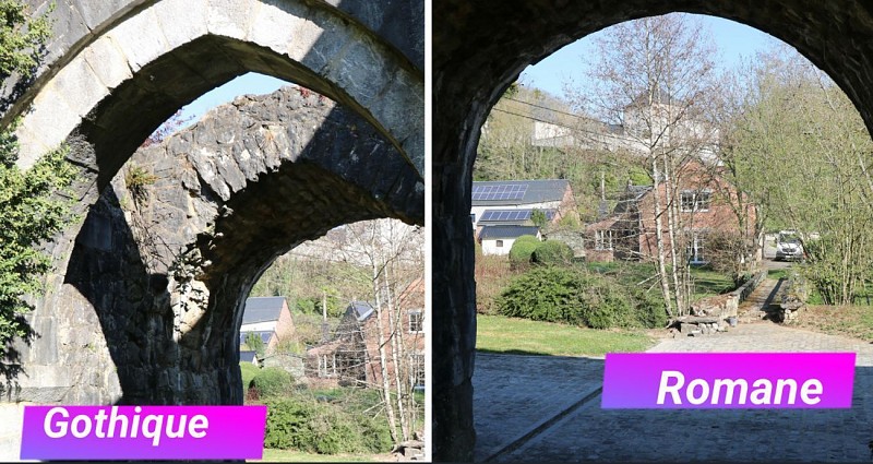
Revogne was a Merovingian domain whose name goes back to the Germanic invasions. Its fortified castle, that dates from the beginning of the 10th century, became a military stronghold for the provost-marshal of Liège. This fortified town was surrounded by ramparts, dating from 1242, and had three entrance gates : the Lomprez gate, the Levant (east or rising sun) gate and, the Couchant (west or setting sun) gate. Near the river, you can admire the old medieval city’s last remaining gate, the Lomprez gate, which is gothic on one side, Romanesque on the other.
The Revogne chapel
A couple of years ago, the ruins of the old chapel were discovered in the middle of the woods. The current chapel (which has the Holy Stephen as its patron saint), dates back to 1777. The diminutive steeple boasts a bell from 1502 which used to ring in the Romanesque church near the feudal castle. Such an ancient bell is quite rare; as at the time, bells were often melted down and reused to make canons.
Beauraing walking map
You are almost back at your starting point. We hope you enjoyed this trail and the benefits of nature!
This trail was created by the Beauraing Tourist Office ((+32(0)82/71 11 40 – info@otbeauraing.be – www.otbeauraing.be).
You can buy the map from the Houyet Tourist Office or contact Tourism Famenne-Ardennes: +32(0)84/34 53 27 & info@famenneardenne.be.
Share your most stunning pics on social media using #WeLoveFamenneArdenne or #VisitFamenneArdenne 🙂
See you soon for new adventures in the Famenne-Ardennes area!
www.famenneardenne.be
facebook.com/TourismeFamenneArdennen (FR)
@TourismeFamenneArdenne (FR/EN)


