Circuit Durbuy (Wéris) - Les Mégalithes


Further information
Signalétique (EN)
No signage
IGN MAP

AERIAL PHOTOS / IGN


SLOPE MAP (IGN PLAN)


MAP 1950 / IGN

MAP OF THE GENERAL STAFF (1820-1866)


OPEN STREET MAP


Starting point
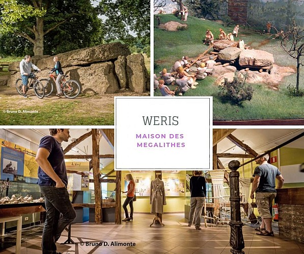
The House of Megaliths
The Megaliths Museum is ideally suited for visitors and ramblers wishing to discover thearea, more specifically the megalithic field – unique in Belgium – that stretches out over more than 8km. Visit the museum, and discover the Neolithic period and the culture of the
www.megalithes-weris.be/
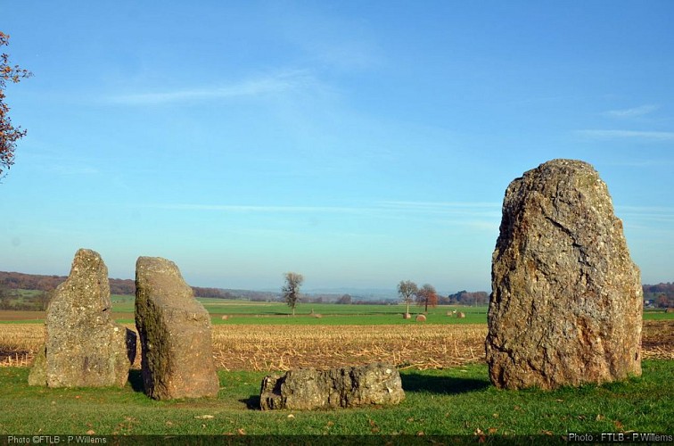
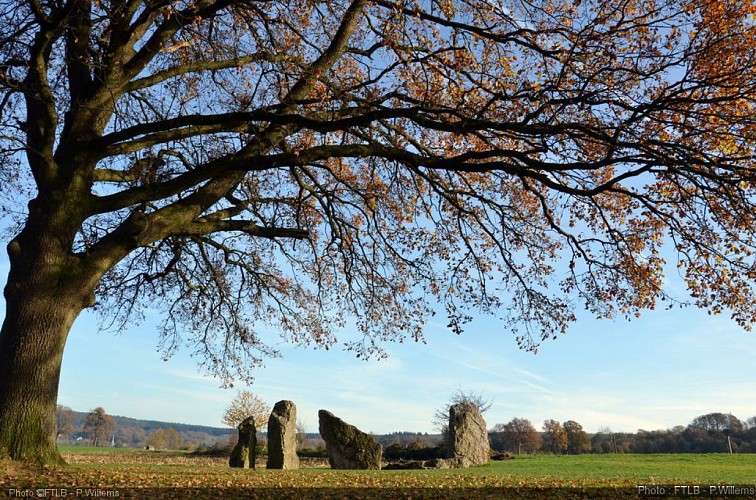
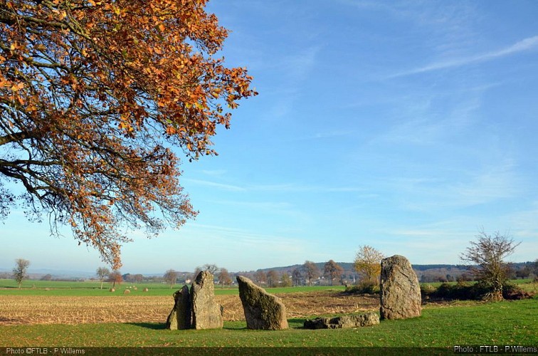
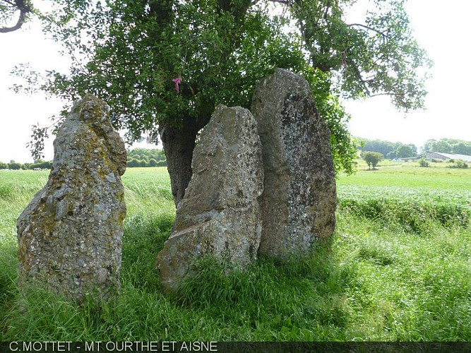
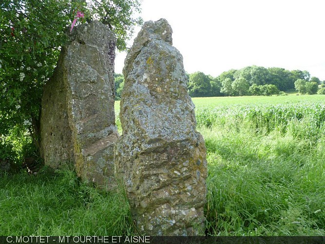
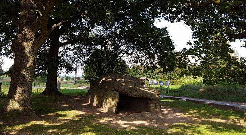
The three dolmens of Oppagne
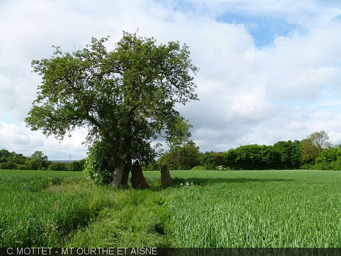
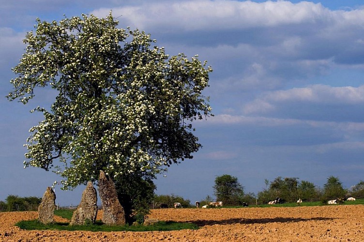
The three menhirs in Oppagne are part of the exceptional ensemble of megalithic monuments that are dotted across the council of Durbuy, covering an area that is over 8km long and 300 m wide. They date back to 5,000 years ago, the era of the first Neolithic famers.
The word ‘menhir’ comes from the Breton word ‘men’ meaning stone, and ‘hir’ meaning long. The menhirs in Oppagne are 2 to 2,7 m high. They are in puddingstone – a naturally occurring rock akin to cement – a rock that was quarried and put to use locally until the First World War.
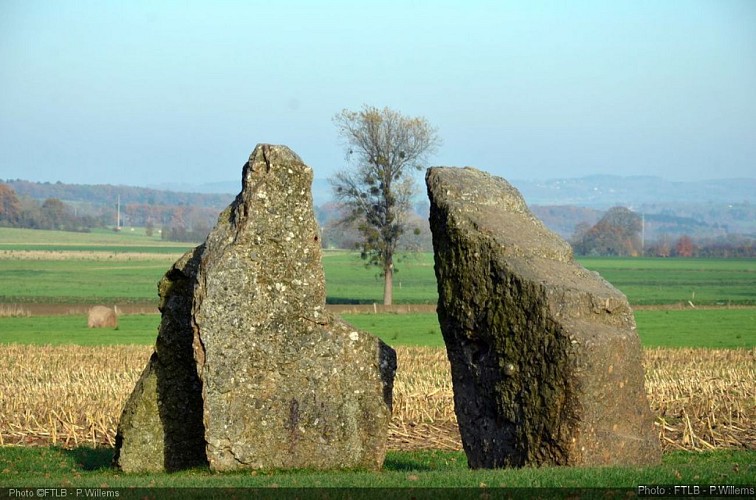
The megalithic site in Wéris
The megalithic site in Wéris stretches out over 8km and is 300m wide. As far as we know, it consists out of two dolmens (= burial chambers), with two menhirs standing in front and several blocks of stone scattered around, as well as 6 locations where you can admire menhirs (standing stones).