

RAVeL foot and cycle path
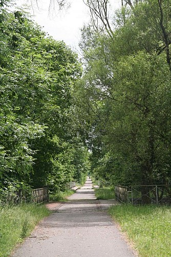


A bit further on, you can spot one of the many access points to the Autonomous Network of Slow Ways (‘Réseau Autonome de Voies Lentes), known as the RAVel, and which links Jemelle to Houyet. This former railway line was dismantled after 1978 and rehabilitated as a lovely path for pedestrians, cyclists and other vulnerable road users. Several sections of the RAVeL run alongside the Lesse River, revealing some wonderful spots for an al fresco picnic. The distance between Houyet en Vignée is 6,2 km and Houyet and Rochefort are separated by 18,2 km
7 Rue de la Station
5560
Houyet
Lat : 50.18948Lng : 5.00692
118 m
Select background map
IGN MAP

AERIAL PHOTOS / IGN


SLOPE MAP (IGN PLAN)


MAP 1950 / IGN

MAP OF THE GENERAL STAFF (1820-1866)


OPEN STREET MAP


Nearby tours
Author Information

MTFA
Author


