

The Porte Aïve Cave

Credit : FTLB - P.Willems
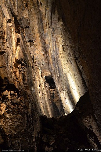
The Porte Aïve Cave (which means "high door") is located on the left bank of the Lisbelle stream, a tributary of the Ourthe and is of great archaeological (and geological) interest. Archaeological digs were carried out in the cave in 1907-1908, as well as in 1956. During the first digs, that mainly focused on the porch and terrace, a sepulture from the neolithic was discovered (9,900 to 3,300 B.C). Interesting fact: in late 1944, the Germans had set up a command post in the cave.
Rue Grand-Mont
6990
Hotton
Lat : 50.26943Lng : 5.47407
Select background map
IGN MAP

AERIAL PHOTOS / IGN


SLOPE MAP (IGN PLAN)


MAP 1950 / IGN

MAP OF THE GENERAL STAFF (1820-1866)


OPEN STREET MAP


Nearby tours
Author Information

MTFA
Author


