

The river Lesse
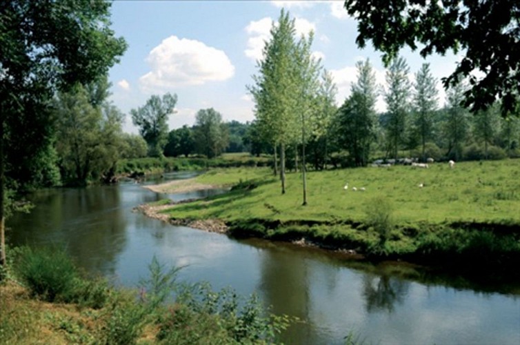

This emblematic river has it source in the Province of Namur, more specifically in Ochamps, and winds its way northwards for about 84km (approx 52.2 miles). The Lesse crosses though the villages of Daverdisse, Halma, Chanly and Resteigne, and then plunges into the sinkhole of Belvaux on the heights of Han-sur-Lesse before reappearing at the cave exit and flowing towards Lessive, Villers-sur-Lesse and Houyet, terminating its journey in Anseremme, where the river flows into the Meuse. The Lesse is home to trout, grayling, pike, barbel, carp, chub, eels, minnows, gudgeon, grey slugs and lamprey...
62 Rue du Camp Romain
5500
Dinant
Lat : 50.21108Lng : 4.95003
106 m
Select background map
IGN MAP

AERIAL PHOTOS / IGN


SLOPE MAP (IGN PLAN)


MAP 1950 / IGN

MAP OF THE GENERAL STAFF (1820-1866)


OPEN STREET MAP


Nearby tours
Author Information

Maison du Tourisme Explore Meuse
Author


